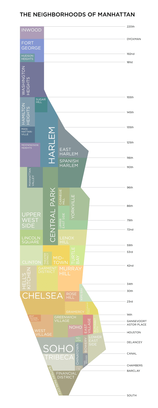
This is a list of neighborhoods in the New York City borough of Manhattan arranged geographically from the north of the island to the south.
The following approximate definitions are used:
- Upper Manhattan is the area above 96th Street.
- Midtown Manhattan is the area between 34th Street and 59th Street.
- Lower Manhattan is the area below 14th Street.
- West Side is the area west of Fifth Avenue; East Side is the area east of Fifth Avenue.
Neighborhood names and boundaries are not officially defined. They may vary or change from time to time due to demographic and economic variables.
Uptown neighborhoods
Midtown neighborhoods
Between Midtown and Lower Manhattan
† Large scale developments
Lower Manhattan neighborhoods
† Large scale developments
Islands
- Ellis Island
- Governors Island
- Liberty Island
- Randalls and Wards Islands
- Roosevelt Island
See also
- Neighborhoods in New York City
- List of Bronx neighborhoods
- List of Brooklyn neighborhoods
- List of Queens neighborhoods
- List of Staten Island neighborhoods
- Tin Pan Alley (Location)
References
External links
- Media related to Neighborhoods in Manhattan, New York City at Wikimedia Commons
- "Manhattan Development Maps", New York City Housing Authority
- "New York: A City of Neighborhoods" (map), New York City Department of City Planning (archived March 6, 2009)